Thursday, December 21, 2006

Mountain Visions (a short experiment)

Click on the image to view a QuickTime movie in a 1280 x 720 window size.

For more than 3 decades we (Mountain Visions) have been creating multimedia sequences, often using still images and music. Now, for 12 years since 1995 we have been creating multimedia for web sites.

This short 720p sequence is an experimental project I started to work with in an attempt to create a "trailer" for Blip.tv. It is not finished yet, but I decided to upload it to see how it looks. The images are 1. Total Solar Eclipse, 2. Climbers on Denali, and 3. Woman holding the Sun. I shot all of the images originally in the 1970s. Photo to Movie was used to create the motion and dissolves. iMovieHD was used to create the titles and to add the music track.

Eric Sandmeyer has gratiously allowed me to use a sound file titled "Microscope" he has composed.

Sunday, December 10, 2006

720p Google Earth fly in to River Menders project with music

Click on the image at the left to view a High Definition 720p video I created using Google Earth Pro and Final Cut Pro with a video I shot at a River Menders restoration location on the Little Salmon River in Idaho. Mary Dudley, Idaho Fish and Game Volunteer Coordinator, narrates the movie. Eric Sandmeyer created a music background bed for the whole video.

This High Definition 720p movie (Screen Size 1280 x 720)
is hosted on my Blip.tv space where you can also watch it in a flash format and an interesting new "full screen" format.

Web sites are available for the River Menders Project, and samples of Eric Sandmeyer's music.

Tuesday, November 28, 2006

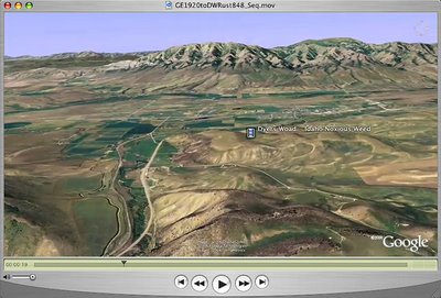
Google Earth fly in to an Idaho Noxious Weed-Dyers Woad

Click on the image to the left to watch a QuickTime Google Earth Fly in above Idaho to a location in Bannock County where there is an infestation of Dyers Woad. The fly in dissolves to a video narration with Dave Hallinan, Bannock County Weed Supervisor, explaining to Roger Batt, Idaho Weed Awareness Campaign Coordinator, how a fungus called rust acts as a bio control agent.

This High Definition 720p movie (Screen Size 1280 x 720)
is hosted on my Blip.tv space where you can also watch it in a flash format and an interesting new "full screen" format. Also note that I created the original Google Earth Fly in movie was in a true High Definition window size (1920 x 1080) and the HDV video content was edited in Final Cut Pro in the same size.

Eric Sandmeyer has gratiously allowed me to attach a portion of his "Soaring" sound file to this movie. This music really adds to the fly in.

We (Mountain Visions) are creating a web site for the Idaho Weed Awareness Campaign. A full screen 360 degree panorama and additional video sequences describing Dyers Woad are available to view if you click here.

Friday, November 10, 2006

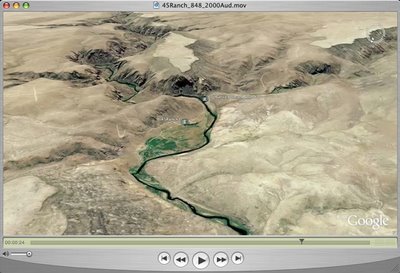
Google Earth Fly in to Owyhee Canyonlands - 45 Ranch

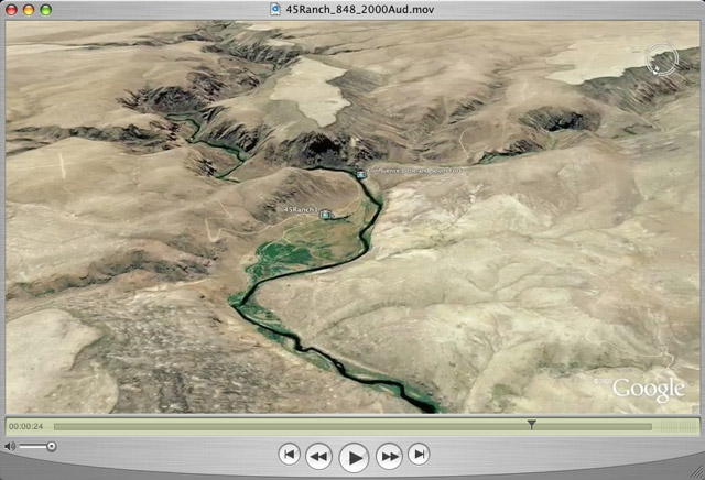
Click on the image to the left to watch a QuickTime Google Earth Fly in above Idaho to the 45 Ranch in the Owyhee Canyonlands area. This movie (Screen Size 848 x 480)
is hosted on my Blip.tv space where you can also watch it in a flash format.
Eric Sandmeyer has gratiously allowed me to attach his "Idaho Song" sound file to this movie.

We (Mountain Visions) have also published a series of full screen 360 degree interactive panorama views from many places in the Owyhee Canyonlands.

In the Google Earth browser we have produced a KMZ file that will let you fly around the Owyhee Canyonlands area and see these full screen panoramas in the geographic location where they were photographed. I can't find how to load this file onto this page for people to download. However, I have posted two Owyhee Canyonlands KMZ files on the River Menders Wiki Google Earth page. You can download them there.

Another Source of information and panoramas taken in 1997 at the 45 Ranch can be found on the Aurora Project section of our web site.

Link to Owyhee Initiative web site.

Wednesday, November 01, 2006

River Menders Volunteers in Idaho

I have uploaded this video to You Tube to determine the quality compared to Google Video and BlipTv. I have uploaded videos to YouTube and Google Video in the past, but have not been satisfied with the play back quality.

This is the YouTube address for my videos. (This is the only one, for now)
http://www.youtube.com/watch?v=JOj1KvNpmEs

Monday, October 16, 2006

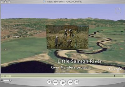
Google Earth Movie (848 x 480) dissolves to volunteer workers

Click on the image to the left to view the movie. The original was produced in HDV 720P . This movie has been reduced in Window size to 848 x 480. It is an experimental movie to create a dissolve transistion between a Google Earth movie and a HDV sequence taken on the ground at the same spot where the fly in ends. The video was taken on September 30, 2006. You can also see this video at my Blip.tv space.

It starts with a view high above idaho and flys down toward the Little Salmon River, near New Meadows Idaho. A group of "River Mender" volunteers have been engaged for several years in rehabilitating the vegetation along the river bank. An audio track is provided to explain some details of the project.

An interactive web site is "under construction" for the River Menders project.

Tuesday, October 10, 2006

Google Earth pro movie to Idaho's Little Salmon River restoration workers

Click on the image on the left or this link to view a High Definition Google Earth Pro movie in a 1280x720 window size. This video is being stored on blip.tv at my blog - gogrimm.blip.tv.

Note that on October 1, I posted an earlier video showing the eroded river bank in this area, before restoration work. This one shows workers creating a "willow weaving net" to stablize the bank.

Also the Google Earth maps for Idaho have been updated with higher resolution throughout the state. This video shows the higher resolution that is available now.

We are currently producing a River Menders interactive web site that is "under construction" to describe the restoration work in Idaho, including the Little Salmon River area.