Monday, October 16, 2006

Google Earth Movie (848 x 480) dissolves to volunteer workers

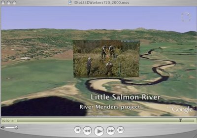
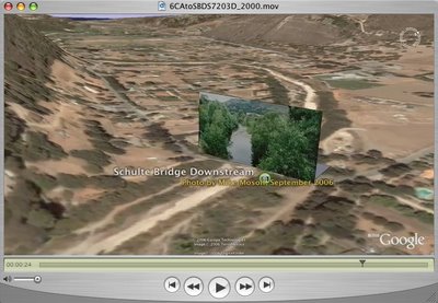
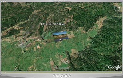
Click on the image to the left to view the movie. The original was produced in HDV 720P . This movie has been reduced in Window size to 848 x 480. It is an experimental movie to create a dissolve transistion between a Google Earth movie and a HDV sequence taken on the ground at the same spot where the fly in ends. The video was taken on September 30, 2006. You can also see this video at my Blip.tv space.

It starts with a view high above idaho and flys down toward the Little Salmon River, near New Meadows Idaho. A group of "River Mender" volunteers have been engaged for several years in rehabilitating the vegetation along the river bank. An audio track is provided to explain some details of the project.

An interactive web site is "under construction" for the River Menders project.

Tuesday, October 10, 2006

Google Earth pro movie to Idaho's Little Salmon River restoration workers

Click on the image on the left or this link to view a High Definition Google Earth Pro movie in a 1280x720 window size. This video is being stored on blip.tv at my blog - gogrimm.blip.tv.

Note that on October 1, I posted an earlier video showing the eroded river bank in this area, before restoration work. This one shows workers creating a "willow weaving net" to stablize the bank.

Also the Google Earth maps for Idaho have been updated with higher resolution throughout the state. This video shows the higher resolution that is available now.

We are currently producing a River Menders interactive web site that is "under construction" to describe the restoration work in Idaho, including the Little Salmon River area.

High Definition Google Earth Fly in to a Real photograph on the Carmel River, CA

Click on the image or this link to view this High Definition video with a window size of 1280 x 720 from Blip.tv This is the same video I posted yesterday that was viewable in a 720x405 window size. It is a Google Earth Fly in to a simple verticle billboard photograph recently taken showing a downstream view from the Schulte Bridge on the Carmel River. Successful riparian restoration efforts starting in the 1980s are very visibile in the plush tree growth on both sides of the river in the photograph.

We have started a Carmel River Wiki Spaces project where people can discuss issues and submit stories and photographs representing restoration efforts on the river.

Monday, October 09, 2006

Google Earth fly in to Carmel River photo


Click on the image at the left to view a 720x 405 QuickTime video that flys down to a simple vertical 3D billboard I created with Google Sketchup that shows a September 2006 photograph of view downstream of the Shulte Bridge on the Carmel River, in California. The same file can be found at my upload space on Blip.tv.

The original video was produced in a High Definition screen size of 1280 x 720 and I may add it to the Vlog too.

We have started a Carmel River Restoration Wiki Spaces project to encourage people to submit photographs and stories related to changes and restoration efforts that have taken place on the river.

Sunday, October 01, 2006

Google Earth Pro Movie fly in to real photograph

Click the image to the left to see a High Definition video clip produced in a 1280 x 720 window size with the QuickTime .H264 codec.

Click here to view the Google Earth Fly in to a real photograph on the Little Salmon River. This will present a Blip.tv page with a smaller window and an option to view in Flash or QuickTime.

I think I have found that Blip.tv, one of the Internet video servers, can play High Definition Video close to the same quality that I see them when I compress them for the web. Click on the graphic image of the video above above to see the video in a large window.

This video is being hosted at Blip.tv. If you click on the Text link above it can be viewed in Flash or in QuickTime in a smaller window. Quicktime provides better quality.